Superfund Records Center records
Collection
Identifier: ACCN 2107
North Facilities soils and wastewater treatment plant ponds site removal action, SSID#4B: Refinery area post removal / post reclamation, volume 6 [part 2]
Digital Record
Identifier: ark:/87278/s691a93s

North Facilities soils and wastewater treatment plant ponds site removal action, SSID#4B: Refinery area post removal / post reclamation, volume 6 [part 3]
Digital Record
Identifier: ark:/87278/s6jdwfcd
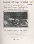
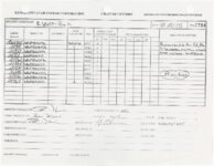
North facilities soils and wastewater treatment plant ponds site, removal action SSID#4B: Refinery area site characterization [part one]
Digital Record
Identifier: ark:/87278/s6g08fqt
North facilities soils and wastewater treatment plant ponds site, removal action SSID#4B: Refinery area site characterization [part two]
Digital Record
Identifier: ark:/87278/s6wsdp81
North facilities soils and wastewater treatment plant ponds site, removal action SSID#4B: Refinery area site summaries and characterization sampling reports [part 1]
Digital Record
Identifier: ark:/87278/s6qhknb0

North facilities soils and wastewater treatment plant ponds site, removal action SSID#4B: Refinery area site summaries and characterization sampling reports [part 2]
Digital Record
Identifier: ark:/87278/s6dmgtkx
Notice of completion and final report for Kennecott work activities related to the administrative order on consent for sludge removal action in Large Bingham Reservoir site no. R3 [part 4]
Digital Record
Identifier: ark:/87278/s60rj0re


Notice of completion and final report for Kennecott work activities related to the unilateral administrative order for removal action, Site no. T4, Bingham Creek channel, Phase II, mixed tailings area: Large Bingham Reservoir dam to Highway 111 [part two]
Digital Record
Identifier: ark:/87278/s69ctqjm
Oquirrh Range site investigations, 1996
Digital Record
Identifier: ark:/87278/s690eq9k
Phase I sampling and analysis plan for the study of the uptake of lead and arsenic into agricultural crops at the Kennecott sites, Oquirrh Mountains, Utah; Uptake of arsenic and lead by wheat at the Kennecott sites, Oquirrh Mountains, Utah
Digital Record
Identifier: ark:/87278/s67s4s77
Found in:
J. Willard Marriott Library Special Collections
/
Superfund Records Center records
/
Environmental Protection Agency
/
Phase I sampling and analysis plan for the study of the uptake of lead and arsenic into agricultural crops at the Kennecott sites, Oquirrh Mountains, Utah; and Uptake of arsenic and lead by wheat at the Kennecott sites, Oquirrh Mountains, Utah, 1994-1995
Post-removal sampling of the Butterfield waste rock pile area
Digital Record
Identifier: ark:/87278/s6p17q7m
Post-removal sampling of the Butterfield waste rock pile area
Digital Record
Identifier: ark:/87278/s6qdcexk

Preliminary endangerment assessment, Bingham Creek channel, phase 2, with related documents
Digital Record
Identifier: ark:/87278/s6sae94w
Preliminary risk evaluation of sulfate : report for the Bingham Creek / ground water, Jordan Valley, Utah
Digital Record
Identifier: ark:/87278/s6x9dgxt
Problem formulation report, screening level for the ecological risk assessment, Kennecott Utah Copper, Salt Lake City, Utah
Digital Record
Identifier: ark:/87278/s6x7r1a7
Proposed land use and building controls, unincorporated Salt Lake County properties in the Bingham Canyon area
Digital Record
Identifier: ark:/87278/s6w19pa0
Public health assessment for Kennecott (north zone), Magna, Salt Lake County, Utah: CERCLIS no. UTD070926811; Public health assessment for Kennecott (south zone), Magna, Salt Lake County, Utah: CERCLIS no. UTD000826404
Digital Record
Identifier: ark:/87278/s6fp0yrt
Found in:
J. Willard Marriott Library Special Collections
/
Superfund Records Center records
/
Environmental Protection Agency
/
Public health assessment, Kennecott (north zone), Magna, Salt Lake County, Utah; Public health assessment, Kennecott (south zone), Magna, Salt Lake County, Utah, 1996-1997